Ebert, T., Mewes, L., Götz, F. M., & Brenner, T. (2022). Effective maps, easily done: Visualizing geo-psychological differences using distance weights. Advances in Methods and Practices in Psychological Science, 5(3), 251524592211018. https://doi.org/10.1177/25152459221101816
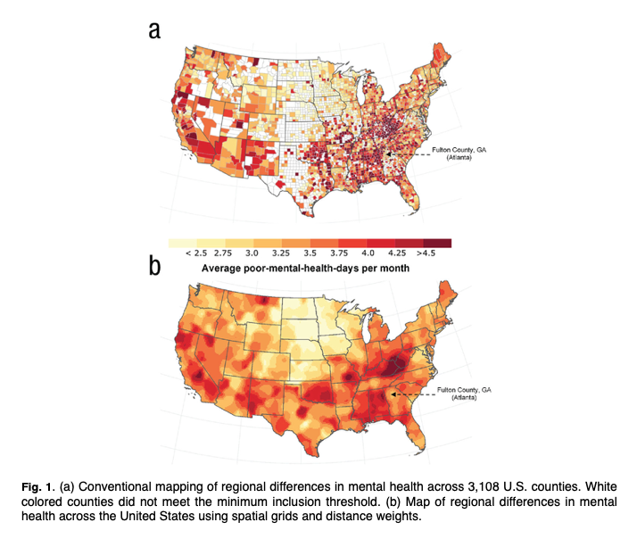
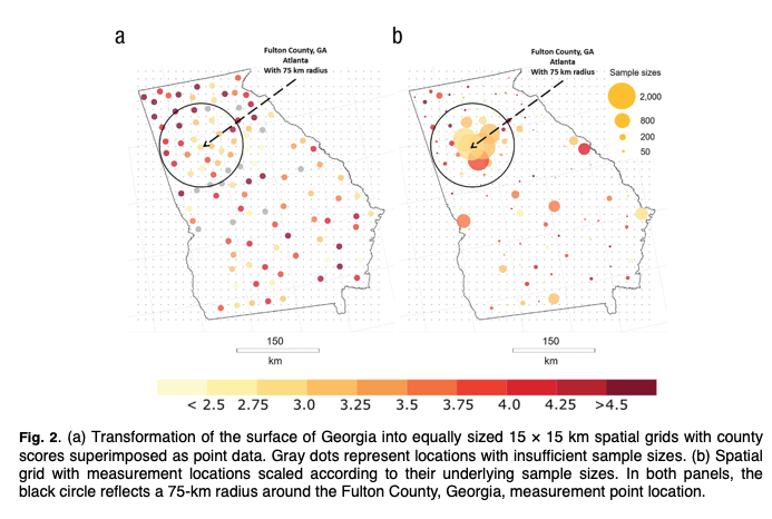
Psychologists of many subfields are becoming increasingly interested in the geographical distribution of psychological phenomena. An integral part of this new stream of geo-psychological studies is to visualize spatial distributions of psychological phenomena in maps. However, most psychologists are not trained in visualizing spatial data. As a result, almost all existing geo-psychological studies rely on the most basic mapping technique: color-coding disaggregated data (i.e., grouping individuals into predefined spatial units and then mapping out average scores across these spatial units). Although this basic mapping technique is not wrong, it often leaves unleveraged potential to effectively visualize spatial patterns. The aim of this tutorial is to introduce psychologists to an alternative, easy-to-use mapping technique: distance-based weighting (i.e., calculating area estimates that represent distance-weighted averages of all measurement locations). This paper outlines the basic idea of distance-based weighting and explain how to implement this technique so that it is effective for geo-psychological research.